


TOP 10 of the most beautiful hikes to do in Ariège: from easy hikes to mythical summits
CampingS

&
– ariège
Ariège,
land of hikers
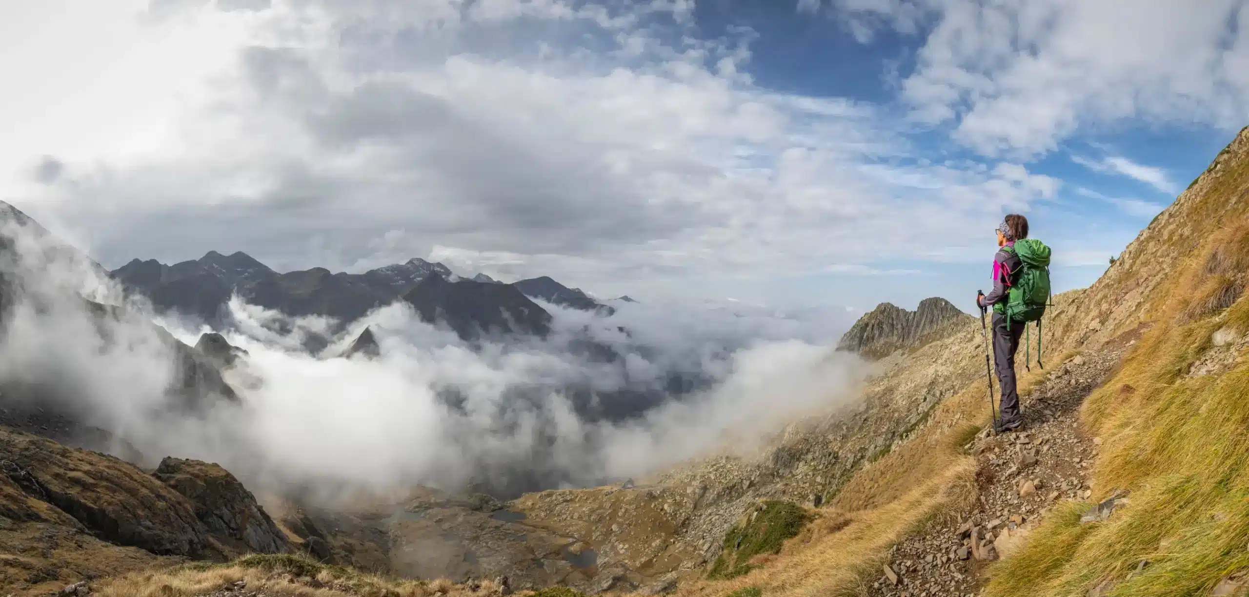
Less frequented than its Pyrenean neighbors, Ariège cultivates a rougher, quieter and more demanding mountain environment. With its high-altitude lakes, aerial ridges and summer pastures overlooking Andorra, the playground is vast. Here are the 10 must-do hikes in Ariège, from itineraries accessible to families to summits reserved for seasoned walkers. A clear guide to choosing the right trail, at the right level.
Family outings
high mountain climbing
Hiking
Easy Ariege
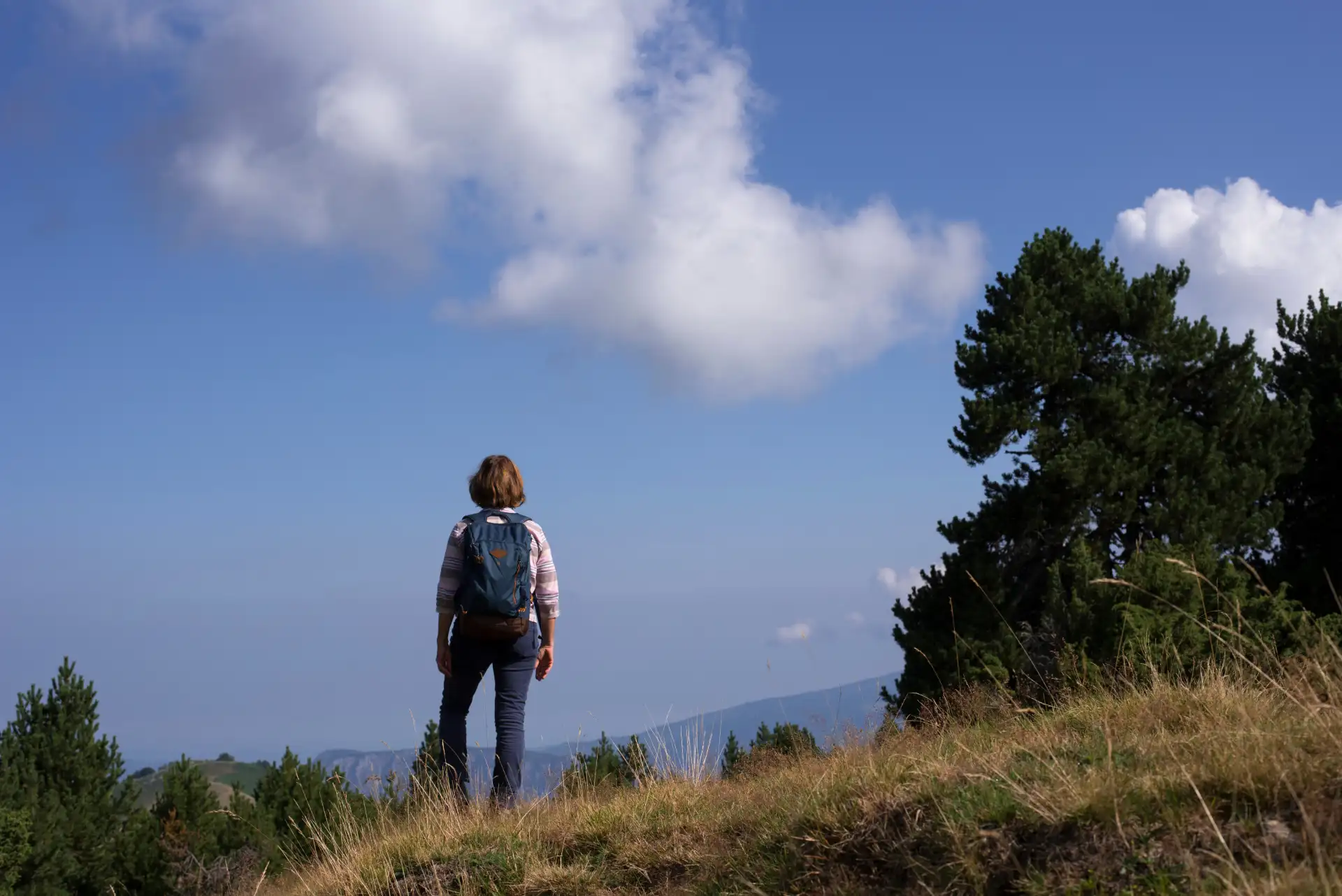
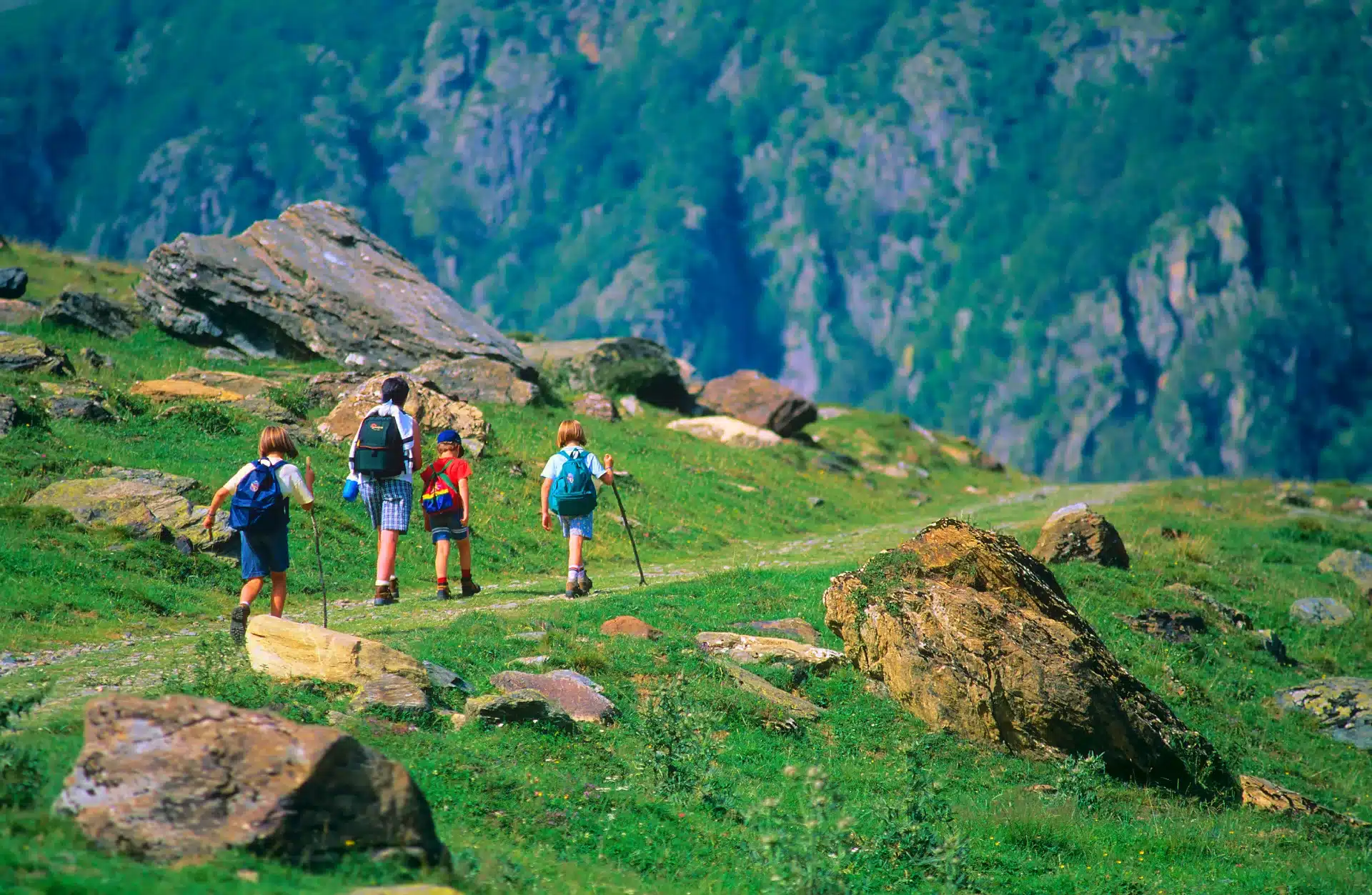
The best family hikes (Level 1-2)
Are you discovering the Ariège mountains for the first time, are you hiking with children, or do you simply want to enjoy nature without getting into trouble? These easy hikes in the Ariège are for you. The trails are well-marked, the gradients are reasonable, and the scenery will delight your eyes without tiring your legs.
1. The Plateau de Beille and its mountain pastures
The Plateau de Beille is the ideal gateway to the high mountains of the Ariège. Accessible by car at altitudes of up to 1,800 metres, it offers a panoramic view of the Andorran and Catalan crests from the moment you arrive. Signposted paths lead through estives and alpine pastures where cows and horses graze freely. In summer, marmots whistle just a few meters away, and isards can be observed through binoculars on the ridges. A place of freedom and rejuvenation, ideal for introducing little ones to the mountains.
- Start / Finish: Plateau de Beille parking lot, multiple loops on site
- Distance varies: 3 to 10 km depending on the route chosen
- Duration: 1h30 to 4h depending on the route
- Difficulty: level 1, accessible to all, including off-road baby carriages
- Attractions: panoramic views of the Andorran Pyrenees, alpine fauna (marmots, isards), mountain pastures and free-ranging herds.
Practical tips: set off early in the morning to see the wildlife first thing in the morning. Bring an extra layer: it can be cool even in midsummer at this altitude. The access road is closed in winter, when the plateau becomes a cross-country skiing and snowshoeing area.
2. Gorges de la Frau and Château de Montségur
Two jewels, one natural, the other historical, combined in one memorable day. The Gorges de la Frau are a deep, shady forest canyon, traversed by a path running alongside the Douctouyre in cathedral-like silence. At the exit, the Montségur plateau is revealed, dominated by the Cathar Pog. The final ascent to the fortress is steep but short – around 30 minutes of climbing – and the reward is well worth the effort: the view plunges over the whole Pays d’Olmes, and the historical emotion of the place does the rest.
- Departure / Arrival: Village of Bélesta (entrance to the gorges) – round trip or circuit via Montségur
- Distance: approx. 12 km round trip
- Duration: 4 to 5 hours
- Difficulty: Level 2, sustained final climb to the castle over 30 minutes, not recommended for very young children.
- Attractions: wooded gorges, waterfalls, 13th-century Cathar castle of Montségur, panoramic view of the Pays d’Olmes.
Practical tips: Combine with a visit to the site museum at Montségur. The gorges are cool and ideal for hot summer days. Good spiked shoes are essential for the ascent to the Pog, which can be slippery after rain.
3. Lac d’Orédon and its easy banks
This small, crystal-clear high-altitude lake is a family paradise nestled in the heart of the Ariège Pyrenees. Accessible via a wide, signposted path, it offers an enchanting backdrop of flower-filled meadows and snow-capped peaks, perfect for children’s first discovery of the mountains. The flat banks make picnics, games and wildlife observation effortless, in a serene and relaxing atmosphere.
- Start/Finish point: Parking du Lac d’Orédon (via Sentier des Lacs, Aulus-les-Bains valley) – loop circuit along the riverbanks.
- Distance: 4 to 6 km
- Duration: 1h30 to 2h30
- Difficulty: Level 1 – Wide, flat trail, accessible to all-terrain baby carriages
- Places of interest: turquoise lake, whistling marmots, ibex in the distance, shaded picnic areas
Practical hints: Ideal for families aged 3 and over. Bring a picnic and a blanket to lie on at the water’s edge. Pay parking in July and August (€5-7/vehicle). Bring binoculars to observe wildlife without disturbing it. Perfect in the morning to avoid the summer crowds.
Accessible challenges,
unforgettable landscapes
The perfect balance between
effort and panorama
The most beautiful hikes for intermediate walkers (Level 2-3)
Do you hike a few times a year, are you in good physical condition and looking for beautiful mountain days to remember? These hiking itineraries in Ariège offer the best effort-to-wonder ratio. Allow between 4 and 6 hours’ walking, with gradients of between 500 and 800 metres, and enjoy landscapes that are well-deserved but require no special technique.
4. Tour des Lacs de Bassiès
This loop from Auzat is one of the great classics of the Haute-Ariège – and one of the most beautiful. It follows a series of glacial lakes nestled in a wild combe, far from any road. The waters shimmer in the sunlight, the granite rocks plunge into the blue, and the silence is broken only by the lapping of the water and the call of a bird of prey. A landscape at the end of the world, less than three hours by car from Toulouse. Please note: the final ascent to the Combe de Bassiès has a few boulder-climbing passages that deserve attention.
- Start / Finish : Auzat, Vicdessos valley – loop
- Distance: Approximately 16 km
- Duration: 5 to 6 hours
- Difficulty: Level 2-3 – Well-marked trail, some rocky sections at the end of the climb
- Sites of interest: Nérech waterfall, Gnioure, Moussières and Bassiès lakes, birds of prey (kites, buzzards, sometimes golden eagles).
Practical tips: Start at 8 a.m. at the latest to take advantage of the calm of the lakes before the summer rush. Pack a full picnic: no refreshments available on the circuit. Download the GPX route before setting off, as signs may be missing in the upper combe.
5. Lac de Fontargente (2,153 m)
From Ax-les-Thermes, the Fontargente summer pastures trail is a gradual ascent through a landscape that changes with altitude. From pastures to the first rocks, then to the turquoise waters of the high-altitude lake, the discovery is constantly renewed. The climb takes you through pasturelands frequented by herds of semi-wild horses – an encounter that never fails to surprise. As you approach the lake, the valley floor closes in on an austerely beautiful granite cirque, with a direct view of the Andorran ridge line.
- Start / Finish: Pla de Las Peyres (Aston), parking du Teichert – round trip
- Distance: 7-8 km round trip
- Duration: 3h
- Difficulty: Level 2 – Steady climb with no technical sections, suitable for moderately trained hikers (+460m D+)
- Attractions: High-altitude mountain pastures, semi-wild horses and herds, Fontargente lake, ibex on border ridges.
Practical advice: avoid very hot days: exposure is total above 1,800 m. Bring at least 2 liters of water per person. Sunscreen factor 50 and category 3 sunglasses are essential in summer. Ibex are most visible in the early morning and late afternoon – binoculars recommended.
6. Pic de Saint-Barthélemy (2,348 m)
From the Col de Péguère, this emblematic summit of the Pays de Sault offers a varied ascent through centuries-old beech forests, flowering alpine meadows and open ridges. The climb is beautiful from start to finish. The view from the summit is breathtaking: on one side the Ariège plains and the Plantaurel, on the other the Pyrenean chain covered in snow until September. A hike that’s demanding enough to be rewarding, yet accessible enough to be shared with a heterogeneous group.
- Start / Finish: Col de Péguère (D16, Pays de Sault) – round trip
- Distance: 12 km round trip
- Duration: 5 to 6 hours
- Difficulty: Level 3 – 700 m vertical drop, varied terrain, some windy sections on ridge
- Attractions: Bélat beech forest, 360° panorama from the summit, griffon vultures in thermal flight, wild orchids in June.
Practical tips: The access road to the Col de Péguère may be snow-covered until May. High boots are mandatory for the ridge terrain. Bring a windproof jacket: the wind can be strong on the summit ridge, even in fine weather in the valley. A great option for a second week’s vacation in Ariège.
In the footsteps of
major Pyrenean itineraries
Ridges, boulders, steep gradients:
here, experience comes first
Hikes for experienced hikers (Level 3-4)
Do you walk regularly, are you comfortable on rocky, exposed terrain, and are you looking for challenges that match your abilities? Ariège has no shortage of demanding peaks, airy ridges and little-traveled itineraries that reward effort with grandiose panoramas. These four hikes are demanding, but in return they offer emotions that few other massifs can match.
7. Pic des Trois Seigneurs (2,199 m)
A symbol of the Ariège region, this summit is a mythical climb that every seasoned hiker must make at least once. Visible from most of the département, it rewards with a 360° panorama of the central Pyrenees: from the Pic du Midi to the Carlit, via the Andorran peaks. The ascent from Massat or Aulus-les-Bains passes through landscapes of peat bogs, forests and alpine meadows of rare beauty. Crossing between the two valleys, with a car left at each departure point, is the wildest and most recommended option.
- Departure / Arrival: Massat (Col de la Core) or Aulus-les-Bains – round trip or crossing with two vehicles
- Distance: Approx. 18 km cross-country
- Duration: 6h to 7h
- Difficulty: Level 3 – 900 m ascent, no technical passages, but long.
- Attractions: Unique 360° panorama of the central Pyrenees, Pla de la Lau peat bogs, views of the Couserans and Vicdessos regions.
Practical advice: Never attempt this climb on an overcast day or when a thunderstorm is approaching: the ridge is exposed for several kilometers. Leave before 7 a.m. to reach the summit before the heat and thermals of early afternoon. Ideal from June to mid-October. Download GPX route: markings may be missing in ridge areas.
8. Circuit des Lacs du Carlit (Ariege side)
Accessible from Mérens-les-Vals, this border area between Ariège and Cerdagne offers a landscape of pink granite, golden lichens and pure water that is absolutely bewitching. One high-altitude lake follows another in a seldom-visited high-mountain environment, where solitude is almost guaranteed even in the middle of August. The route requires good reading of the terrain and experience of mountain orientation: some passages are not signposted, and GPS alone is not enough in poor visibility.
- Start / Finish : Mérens-les-Vals, Haute-Ariège – loop
- Distance: 18 to 22 km depending on variant
- Duration: 7h to 8h (long day)
- Difficulty: Level 3-4 – High mountain terrain, orientation required, off-trail passages
- Attractions: Succession of high-altitude lakes, characteristic pink granite, golden eagle, panoramic view of Carlit (2,921 m), absolute silence
Practical tips: Bring your own 1:25,000 IGN map and compass as well as your GPS. No huts on the main circuit. Bivouacs possible and regulated (more than 1 hour from roads and villages). Optimum period: July to mid-September. Departure before 7 a.m. imperative for a long day of this type.
9. Crêtes du Tabeil (2,358 m) from Aston
These aerial ridges from Aston offer a vertiginous and historic itinerary, crossing the ancestral summer pastures of the Tabeil massif. Few changes in altitude, but exposed passages bring you face to face with the verticality of the Pyrenees, combining natural feats with a high-mountain atmosphere. An atypical route that appeals to panorama enthusiasts and sensation-seeking walkers alike – provided they’re not afraid of heights.
- Start / Finish : Aston (Aston Valley) – round trip
- Distance: 14 km round trip
- Duration: 5h
- Difficulty: Level 3 – Little ascent but very exposed passages, not recommended for those prone to vertigo (+800m D+)
- Attractions: aerial ridges, historic mountain pastures, panoramic views of the Vicdessos, griffon vultures
Practical advice: Absolutely avoid wet weather: the rock becomes slippery. Do not approach the edge without due care. Combine with a stopover in Aston. A rare, memorable itinerary, 100% Ariège.
10. Le Montcalm et l’État – Le Toit de l’Ariège (3,077 m and 3,143 m)
For real mountain lovers. Montcalm is the highest point in the Ariège; its neighbor, the State, is over 3,000 metres high, with total sovereignty over the entire border massif. The ascent from Pradières is long, physical and demanding, sometimes snow-covered until July on the northern sections. But the grandeur of the place, the feeling of absolute altitude and the purity of the panorama over the Spanish and Catalan Pyrenees put this day in another category. The two summits can be climbed in a single day by trained walkers – it’s a high-mountain traverse in the truest sense of the word.
- Start / Finish : Pradières, Vicdessos valley – round trip
- Distance: 22 km round trip
- Duration: 11-12h (full day, for highly trained hikers)
- Difficulty: Level 4 – 2,000 m+ vertical drop, rocky and sometimes snowy terrain, orientation required, exposed passages
- Attractions: Ariège’s highest point (Montcalm, 3,077 m), State summit (3,143 m), residual glacier, panoramic views of the Spanish and Catalan Pyrenees.
Practical tips: Departure at 5:30-6:00 a.m. imperative: summer thunderstorms often hit the 3,000-meter Ariege as early as 1:00-2:00 p.m. Full high-altitude equipment (light crampons depending on conditions). Consult the high-altitude weather forecast (Météo-France montagne) the evening before. A professional guide is strongly recommended for this climb, especially at the start of the season.
for a serene getaway
in Ariège
Tips for hiking in Ariège
Whatever you choose to hike, always set off equipped with waterproof boots , layered clothing and plenty of water.
Mountain weather changes quickly and without warning – in Ariège in particular, summer thunderstorms can form in a matter of hours on the ridges, even after a bright morning. Before setting off, check the weather conditions.
For level 3 and 4 itineraries, going with a mountain leader is often the best choice.
Focus on the GR10
the legendary Pyrenees route
The GR10 in Ariège: the great Pyrenean crossing
The GR10 is the great hiking trail that crosses the entire Pyrenees chain, from the Atlantic to the Mediterranean. In Ariège, it links Mérens-les-Vals to Aulus-les-Bains, passing through emblematic areas such as Vicdessos and Montcalm.
The Mérens-les-Vals – Refuge du Rulhe stage (approx. 13 km) is one of the most striking sections of the GR10 in Ariège, and quickly plunges you into the mineral atmosphere of the high mountains.
Further west, the Auzat – Refuge du Bassiès traverse (15 to 17 km depending on variant) offers an immersion in the heart of the Vicdessos glacial lakes.
Between Aulus-les-Bains and the Col de la Core (almost 18 km), the trail winds its way along ridges and estives opening onto the Couserans. Reasonable distances for a solid day, provided you’re well prepared.
Hiking in Ariège
WITH VAP Camping
VAP Camping makes it easy to plan your hiking holiday in Ariège.
Our five campsites in Ariège, in the heart of the Ariège-Pyrénées region, are strategic departure points for the department’s most beautiful itineraries.
Our VAP packages allow you to change campsites every 2-3 days to follow a themed hiking trail in the Ariège.
A flexible and efficient organization to devote your week to the essentials: walking, discovering and enjoying the Ariège mountains to the full.